Map of Micanopy from 1895 – 1915
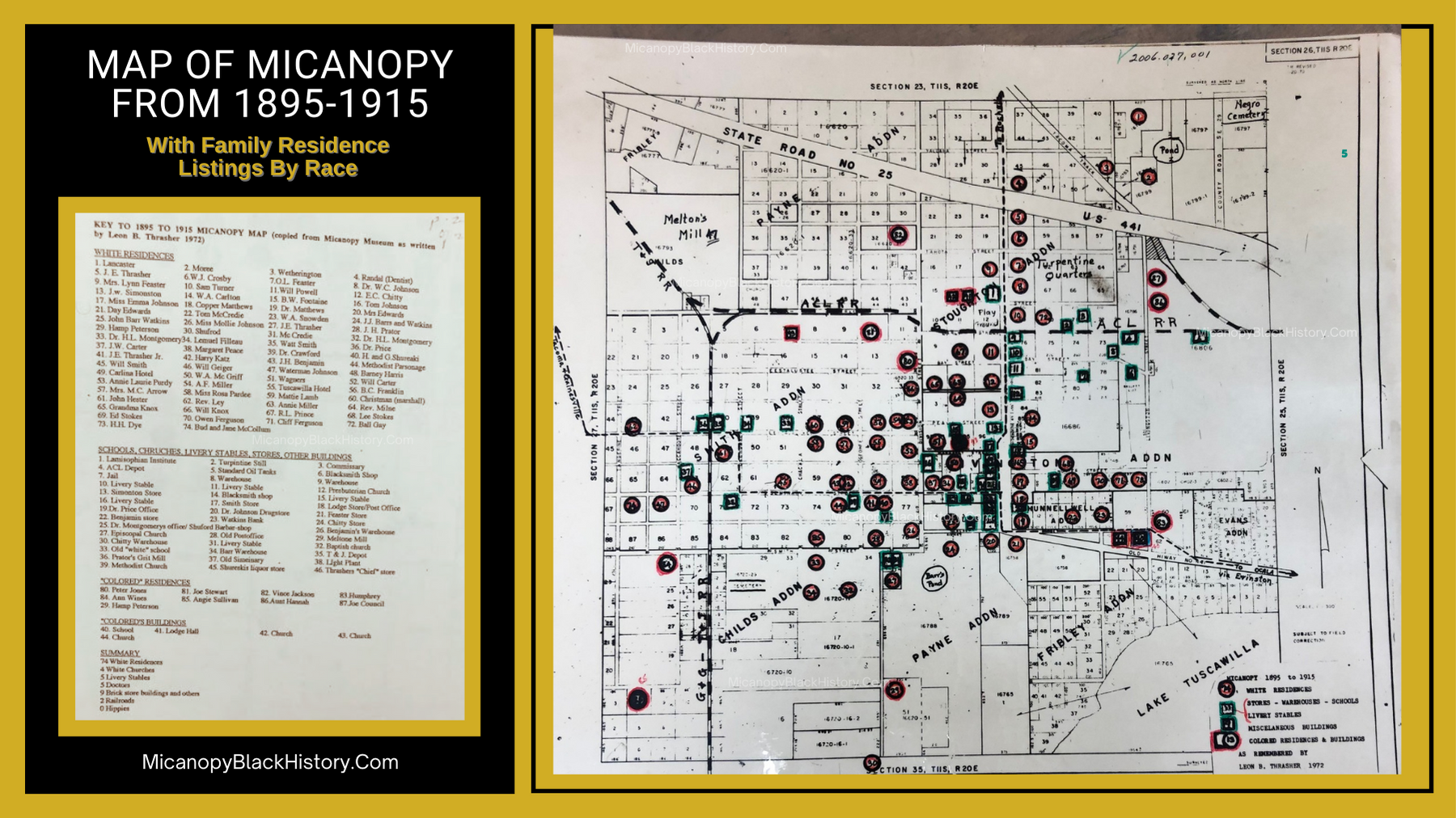
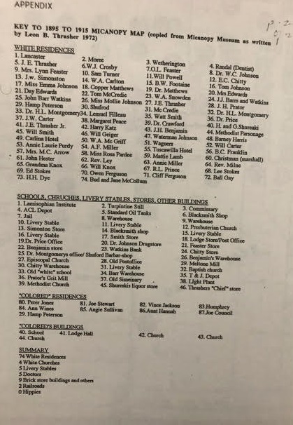
This map of Micanopy was created by Leon Thrasher in 1972. It has a list of all families living in Micanopy and is categorized by race.
CLICK TO ENLARGE IMAGES

(Colored) Black Family Residences listed on the 1895-1915 Map of Micanopy
80. Peter Jones
81. Joe Stewart
82. Vince Jackson
83. Humphrey
84. Anne Wines
85. Angie Sullivan
86. Aunt Hannah
87. Joe Council
88. Hamp Peterson
(Colored) Black Buildings listed on the 1895-1915 Map of Micanopy
40. School
41. Lodge Hall
42. Church
43. Church
44. Church
 Previous Post
 Next Post
")

How could there be so few “colored” residences?
The names may belong to who owned the properties, not who necessarily lived in them.